
Cad & BIM Design Development
We bring together the worlds of CAD, BIM, and GIS to streamline infrastructure planning, design coordination, and asset management. Our team helps engineering firms and government entities integrate their architectural and utility designs into geospatial environments.
By linking BIM models and CAD drawings with real-world geographic data, we enable smarter decision-making across the project lifecycle from initial planning and permitting to operation and maintenance.
Whether it's a utility network, smart building, or infrastructure corridor, our CAD/BIM
GIS workflows deliver accuracy, efficiency, and spatial intelligence in one platform.
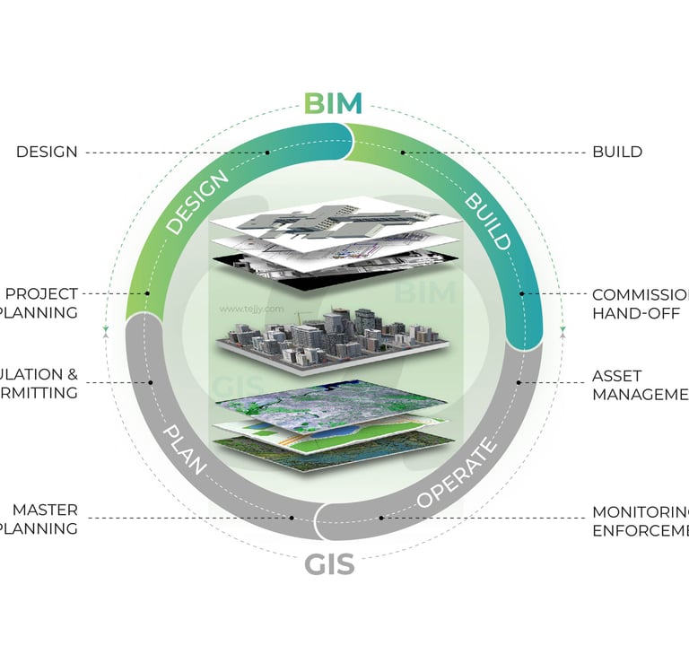
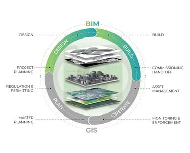
Integrating BIM & GIS
We seamlessly connect Building Information Modeling (BIM) with Geographic Information Systems (GIS) to unlock the full potential of spatially aware design and asset management.
By integrating detailed building models with real-world geospatial data, we enable smarter planning, better coordination, and long-term operational efficiency especially in utility networks, infrastructure projects, and smart cities.
Our workflows help organizations visualize, analyze, and manage their assets from both design and geographic perspectives in a unified environment.